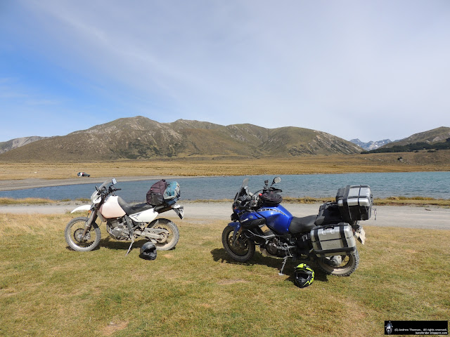
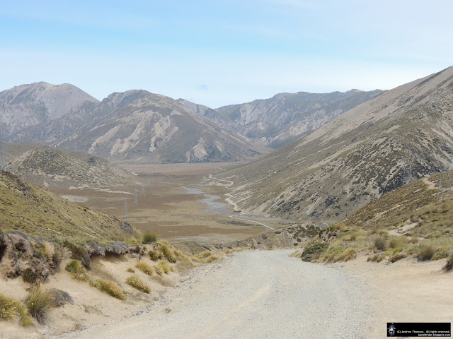
Day Fourteen was intended to be a very relaxed day spent in Richmond with perhaps a little pootle somewhere to see if there was any gravel to be found. It still was, although there was some slight excitement towards the end of the day...
Overnight it had actually rained and I was disappointed that the rain had got in on the bike for a wee while and washed some of the dirt off the bike - the rego plate was readable again...
In the morning I did take it easy. I spent some time uploading some photos from the ride through the Rainbow and generally wasting time in front of the laptop. I did go for a drive with Dan to the house he is currently building and checked out the progress the brickees were making.
While we were having lunch, I started kicking around some ideas with Dan (he is a keen mountain biker) on where I could go exploring. I fired up Mapsource and managed to work out a route from some of his suggestions and then linking the various roads up - it all looked good on the computer...
When I set off the weather was pretty good and even over the entire ride I only ever really got the odd bit of drizzle, roads were occasionally wet though.
I started off retracing my steps from the previous day to Wakefield and then turned to head up into the forestry on Pigeon Valley Road.
Just after the road went to gravel I had my first bit of excitement. As I came off the gravel onto a damp wooden bridge (with a little gas on as there was a hill in my way) the rear end attempted to overtake the front. It was a fairly good slide and I'm picking that a combination of traction control and hitting the gravel again fairly quickly got me out of what would have been even more excitement...
The climb up the hill was a lot of fun and the wee slide hadn't put me off so I soon hit the summit where there were a few possible options for getting lost...
I bravely trusted my GPS and continued down the hill to Stanley Brook. Then there was a short section of tar on the Motueka Valley Highway before I turned off onto Upper Stanley Brook Road.
Initially this took me through some farmland before finally starting to climb up through a Forestry Block where the road was much skinnier and rougher.
After a few ups and downs and probably (fuzzy memory) turns I came across a skidder site where they were loading up a logging truck.
Just pass the site I turned off again - still following that GPS route - but quickly ran into a locked gate. This is where things started getting even more "interesting". What I should have done was spin around and go back the way I came - while I still remembered the way.
But no, I had to try a different road and trust that the GPS would work it all out...great move...
What this kicked off was a world of pain. With the GPS confidently telling me where to go, I got to explore increasingly more tricky and neglected logging tracks. I could deal with the "bushes" growing in the middle of the road, the rocky bits, the dry fords/drains and even the odd fallen branch but eventually I came across a larger log across the road...
I managed to get the front wheel across the log ok but no amount of herbs and rocking of the bike would get the rear to climb up over the log - I was stuck. And looking further up the track there was another roughly the same sized log across the track...
So now I had to somehow get 260+kg of Yamaha off the log, preferably without damaging it or me in the process. It was slightly concerning.
As you are now reading this, you probably worked out that I did mange the trick. It was not easy, but I got the front wheel back on the same side of the log as the rear and turned around without dropping it.
But I was still lost. Spinning around and riding back the way I'd came got me to another decision. Retrace my steps back up into the exciting stuff or try my luck following the road I was on?
I decided that I'd had enough of the excitement and carried on past the road I'd dropped down. After a little while the road opened out a little with forestry on my right and farmland on my left. Then things got exciting again...
I ran into a decent sized herd of cows (probably 20-30) and they all thought that I was there to kill them or something so headed off at a great rate of knots in the same direction as me. So now I was stuck behind a herd of excited cows who could make around 18km/h but were too scared to pull off into the scrub.
Eventually one of them with a few clues pulled off when we came to a wide patch in the road and a few of her friends took the hint. This split the herd into two...I tried my best to encourage them off the road, slowing down even more when there was a bit of room for them, trying to sneak past (scary) and of course yelling at them...
About 800m up the road one of the others finally had their own little brainwave and also convinced most of the rest of the others too - most. I was now stuck behind a solitary, stubborn, moronic, scared but very fit cow. She took off and maintained a cracking pace for probably another kilometer before I finally was able to delicately pull up beside her and sneak past all the while worrying that she might decide to cut across my bows.
I reckon she ran probably 3km at that 18km/h pace - I would have struggled to do 0.3km! I felt sorry for the poor thing but still wonder what they were doing in that forestry block...
If you check out the map you'll probably noticed that eventually my surroundings got a bit more familiar with the track finally spitting me out on the road I had come in on. With my fuel tank getting nearer to the bottom of the gauge (last top up was in Hamner) I was quite relieved.
But, I still had one little navigational error to go. This time the GPS was right and I was wrong. Instead of turning back towards Tapawera and then Wakefield, I turned the opposite way on the Motueka Valley highway and started heading towards Mot. I soon realised I was going the wrong way when I noticed that the river was on the wrong side of the road...
Oh well, I was just happy to be out of the forest and on some delicious tar so carried on the way I was going before turning towards Upper Moutere - where my fuel gauge did start blinking at me. I stubbornly kept going on wet and slightly busier roads back to Richmond. And so after 160km of a planned 100km ride I was back safe and sound on an undamaged horse - this is why they call it Adventure riding...


